Chile
Chile stretches from the driest desert in the world (but it rained while we visited Atacama) to massive glaciers in the south. The Chileans are very hospitable i.e. always willing to share their drinks and food with visitors. Camping is very popular especially in the summer months, when you will meet locals in the thousands around the beaches, lakes and rivers closer to Santiago. We are very spoilt, the weather has been fantastic so far and we have enjoyed dozens of beautiful sunsets. The roads are great and access is easy to most of the country main attractions. The only thing we are not so happy about is the high prices of food, fuel, gas, camping, national parks, tolls...etc. Chile is worth visiting but include some extra cash in your pockets!!
Arica is an urban beach resort close to the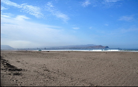 border with Peru. There are many beaches outside the city center where wild camping is allowed, but it can get very windy, the current is really strong and the water is freezing cold. In walking distance to the beach there are many inexpensive camping grounds some with swimming pool. Good to chill out after a long drive from Peru. Shop around to exchange your soles for pesos. The Archeological museum contains a fine collection of pre-Columbian pottery, weaving, wood carving and also the most ancient mummies yet discovered from the Chinchorro culture (8000-2000 BC). border with Peru. There are many beaches outside the city center where wild camping is allowed, but it can get very windy, the current is really strong and the water is freezing cold. In walking distance to the beach there are many inexpensive camping grounds some with swimming pool. Good to chill out after a long drive from Peru. Shop around to exchange your soles for pesos. The Archeological museum contains a fine collection of pre-Columbian pottery, weaving, wood carving and also the most ancient mummies yet discovered from the Chinchorro culture (8000-2000 BC).
Iquique is an important port town with some well-preserved old buildings 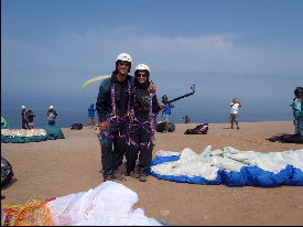 but nothing spectacular. The beaches are reasonable and the shopping enthusiasts can visit tax-free heaven ZOFRI. But Paragliding was the highlight of our visit. We were very happy with the service offered by Altazor, they have a camping ground with lovely views over the ocean (hot shower included!). A visit to nearby Humberstone, the abandoned nitrate ghost town (Unesco Heritage Site) should not be missed; it is at the junction of the Pan-American and the road to Iquique. but nothing spectacular. The beaches are reasonable and the shopping enthusiasts can visit tax-free heaven ZOFRI. But Paragliding was the highlight of our visit. We were very happy with the service offered by Altazor, they have a camping ground with lovely views over the ocean (hot shower included!). A visit to nearby Humberstone, the abandoned nitrate ghost town (Unesco Heritage Site) should not be missed; it is at the junction of the Pan-American and the road to Iquique.
This is supposedly the driest town in the world. I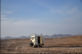 t is very arid here but we saw a small river passing by, so not sure what they mean. Outside this little village there is the Meteorites Valley, perfect to camp overnight. If you don’t feel like sleeping all alone try at the public swimming pool by the river, there is a nice parking lot. This is a sleepy and safe little village. t is very arid here but we saw a small river passing by, so not sure what they mean. Outside this little village there is the Meteorites Valley, perfect to camp overnight. If you don’t feel like sleeping all alone try at the public swimming pool by the river, there is a nice parking lot. This is a sleepy and safe little village.
This is a unique nature reserve 12 km west of San Pedro de Atacama. 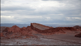 The landscape has been beautifully carved over millions of years by the erosion of its salt mountains and it truly looks like a moon valley. Watching the sunset from the viewpoint is extremely popular so if you want to beat the crowds go before 4 PM and bring along a torch to explore the caves. Unfortunately it is not permitted to stay overnight anywhere inside the park. The landscape has been beautifully carved over millions of years by the erosion of its salt mountains and it truly looks like a moon valley. Watching the sunset from the viewpoint is extremely popular so if you want to beat the crowds go before 4 PM and bring along a torch to explore the caves. Unfortunately it is not permitted to stay overnight anywhere inside the park.
San Pedro is conveniently located: lunar landscapes,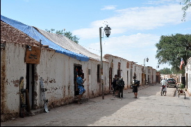 geysers and salt flats are all close by. But in the summer months it is overrun by tourists. They have built this Prehispanic Atacameño town in the center which looks like adobe-landia filled with hostels and tour operators. Before heading to San Pedro buy your own food in Calama, everything is extremely overpriced in this dusty town. Don’t forget to fill up your tank the next petrol station is 200 km away. It is the last town where you can stamp your passport before crossing the border to Bolivia geysers and salt flats are all close by. But in the summer months it is overrun by tourists. They have built this Prehispanic Atacameño town in the center which looks like adobe-landia filled with hostels and tour operators. Before heading to San Pedro buy your own food in Calama, everything is extremely overpriced in this dusty town. Don’t forget to fill up your tank the next petrol station is 200 km away. It is the last town where you can stamp your passport before crossing the border to Bolivia
South of Toconao you will find the entrance to Salar de Atacama, this vast salt lake is the 3rd largest expanse of salt flats in the world and is home to a beautiful flamingo reserve, Reserva Nacional de los Flamencos. The landscape of the Salar is very strange, a big uneven carpet of salt stones until the horizon and beyond. We took the gravel road on the east side towards Antofagasta instead of the Pan-American. This road is in excellent condition and you can enter further in the salt lake and the Atacama Desert. Recommended route. this vast salt lake is the 3rd largest expanse of salt flats in the world and is home to a beautiful flamingo reserve, Reserva Nacional de los Flamencos. The landscape of the Salar is very strange, a big uneven carpet of salt stones until the horizon and beyond. We took the gravel road on the east side towards Antofagasta instead of the Pan-American. This road is in excellent condition and you can enter further in the salt lake and the Atacama Desert. Recommended route.
Antofagasta is a major port for the export of coppe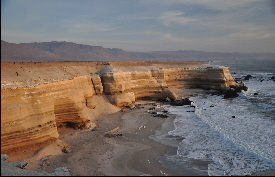 r and it is also a major commercial center for the area. It is not a special place itself but its setting beside the ocean is spectacular. We highly recommend parking overnight at La Portada, 16 km north of town, wonderful views and sunset over the cliff formations. r and it is also a major commercial center for the area. It is not a special place itself but its setting beside the ocean is spectacular. We highly recommend parking overnight at La Portada, 16 km north of town, wonderful views and sunset over the cliff formations.
This is a sleepy fishing port with a mineral processing plant.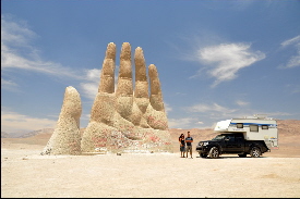 It is having some wild beaches nearby which are popular with locals in the summer months. Just outside town, 2km north there is a pretty beach protected by a bay where camping is not allowed and therefore it is much cleaner than the rest. You can park outside the sandy area, on the gravel road. Great for sunset! It is having some wild beaches nearby which are popular with locals in the summer months. Just outside town, 2km north there is a pretty beach protected by a bay where camping is not allowed and therefore it is much cleaner than the rest. You can park outside the sandy area, on the gravel road. Great for sunset!
This is an typical resort for the bohemian-posh crowd. 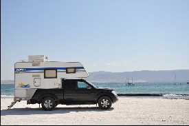 As we visited it in high season, it was packed with Chileans holidaymakers and prices were high. But the weather is good all year long and this is one of the nicest beaches in the area. You will find a waterfront camping overlooking the bay. As we visited it in high season, it was packed with Chileans holidaymakers and prices were high. But the weather is good all year long and this is one of the nicest beaches in the area. You will find a waterfront camping overlooking the bay.
The Elqui Valley is filled with pisco distilleries; it is a center of mystical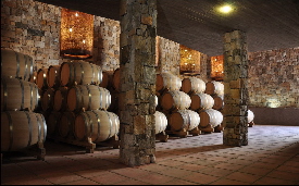 and geomagnetic energy and is having some of the biggest sky observatories and largest telescopes in the world. You can visit some of the observatories on Saturdays but registration in advance is mandatory, check the ESO web site for further info (www.ls.eso.org). Incredible to see these amazing telescopes! Nevertheless the atmosphere at the Elqui Valley is very easy going and relaxed, plenty of camping grounds along the clear river, very difficult to do wild camping. We found the area of Rio Hurtado nicer than the one around Pisco Elqui or Alcohuaz but the connecting gravel road is in some parts full of potholes. and geomagnetic energy and is having some of the biggest sky observatories and largest telescopes in the world. You can visit some of the observatories on Saturdays but registration in advance is mandatory, check the ESO web site for further info (www.ls.eso.org). Incredible to see these amazing telescopes! Nevertheless the atmosphere at the Elqui Valley is very easy going and relaxed, plenty of camping grounds along the clear river, very difficult to do wild camping. We found the area of Rio Hurtado nicer than the one around Pisco Elqui or Alcohuaz but the connecting gravel road is in some parts full of potholes.
This part of the coast north of Santiago is crazy during the summer 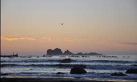 months as it is a major holiday destination. During February it is better to drive along the Pan-American instead of the coastal road. The natural pools at La Campana NP are dry in the summer months same as the surrounding forest, so even though it makes a good stop-over before reaching Santiago, we think it is not worth to pay such a high park entrance at this time of the year. months as it is a major holiday destination. During February it is better to drive along the Pan-American instead of the coastal road. The natural pools at La Campana NP are dry in the summer months same as the surrounding forest, so even though it makes a good stop-over before reaching Santiago, we think it is not worth to pay such a high park entrance at this time of the year.
Santiago during the summer months is a dream: blue sky, no crowds,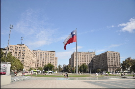 no traffic. Even though this is a big city it doesn’t feel like a metropolis, like for example Bogotá or Lima. To explore the city we recommend free tours with Felipe, a knowledgeable young Santiageño who will show around and give you many insider tips about the city. Santiago is very welcoming and we liked its vibe especially in Bellavista, Lastarriaga and Barrio Brasil area. It is difficult to find a hostel with parking space suitable for campers, try at the International hostel in c/ Cienfuegos. no traffic. Even though this is a big city it doesn’t feel like a metropolis, like for example Bogotá or Lima. To explore the city we recommend free tours with Felipe, a knowledgeable young Santiageño who will show around and give you many insider tips about the city. Santiago is very welcoming and we liked its vibe especially in Bellavista, Lastarriaga and Barrio Brasil area. It is difficult to find a hostel with parking space suitable for campers, try at the International hostel in c/ Cienfuegos.
Colbun Lake is a man-made damn (very low water level in summer)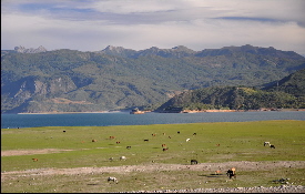 located in a peaceful surrounding in the Maule valley. Good stop over for those driving to Argentina (Paso Pehuenche). The connecting bridge to Linares is owned by the hydroelectric company and the gate is locked, to go south to the Pan-American you need to drive back to Talca. located in a peaceful surrounding in the Maule valley. Good stop over for those driving to Argentina (Paso Pehuenche). The connecting bridge to Linares is owned by the hydroelectric company and the gate is locked, to go south to the Pan-American you need to drive back to Talca.
25 km north of Los Angeles is Salto El Laja, where the Laja River plunges 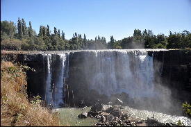 47 meters over the rocks. It is quite commercialized, park outside the gate to avoid paying parking fee. The river is wide and very clean, many locals fill up the nearby camping grounds and cabañas during the summer holidays. 47 meters over the rocks. It is quite commercialized, park outside the gate to avoid paying parking fee. The river is wide and very clean, many locals fill up the nearby camping grounds and cabañas during the summer holidays.
This is the best place in Chile to see Araucaria native forest, which us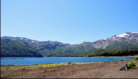 ed to cover most of the area in this part of the country. The park is having beautiful lakes (with sandy beaches), snowcapped volcanoes and lava trails (Llaima volcano erupted in 2008). If entering the park with a camper you can stay overnight without paying the extra fee, ask the CONAF personnel for suitable parking spots. ed to cover most of the area in this part of the country. The park is having beautiful lakes (with sandy beaches), snowcapped volcanoes and lava trails (Llaima volcano erupted in 2008). If entering the park with a camper you can stay overnight without paying the extra fee, ask the CONAF personnel for suitable parking spots.
Southeast of the popular lake resorts of Villarrica and Pucón (extremely packed and overpriced in summer!) 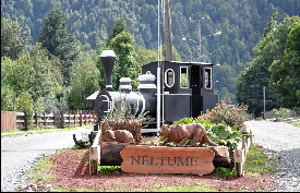 a road leads to Lago Pirehueico passing by Huilo-Huilo reserve. This is a 60,000 acres of private land that is developing the area for low-impact ecotourism. Their hobbit inspired hotel “La Montaña Mágica” is just amazing, really worth a visit. The ferry Hua-Hum travels between Puerto Pirehueico and Puerto Fuy (Argentina) through a long deep lake surrounded by virgin lingue forest. Unfortunately the ship was out of order as we were there. We would like to thank Juan and Paulina for being such great hosts while visiting the area. a road leads to Lago Pirehueico passing by Huilo-Huilo reserve. This is a 60,000 acres of private land that is developing the area for low-impact ecotourism. Their hobbit inspired hotel “La Montaña Mágica” is just amazing, really worth a visit. The ferry Hua-Hum travels between Puerto Pirehueico and Puerto Fuy (Argentina) through a long deep lake surrounded by virgin lingue forest. Unfortunately the ship was out of order as we were there. We would like to thank Juan and Paulina for being such great hosts while visiting the area.
This is the largest island off the extreme south of the continent. The Andes runs f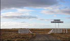 rom west to east, so the north is flat, covered with vast sheep farms, while the south has mountains, lakes and forests. The drive from Rio Grande (Argentina) to Porvenir (Chile) is very special and unique. This is authentic wild and virgin Tierra del Fuego territory. The gravel roads are in general well maintained but it can get very windy; up to 100 km/hr.…even our roof window flew away and we could see the sky from our cabin!! The ferry arrangements in Porvenir are straight forward but pricey. The village is having some old houses built in the 1920’s during the times of prosperity for sheep farming and gold exploitation. Good for a day stroll. rom west to east, so the north is flat, covered with vast sheep farms, while the south has mountains, lakes and forests. The drive from Rio Grande (Argentina) to Porvenir (Chile) is very special and unique. This is authentic wild and virgin Tierra del Fuego territory. The gravel roads are in general well maintained but it can get very windy; up to 100 km/hr.…even our roof window flew away and we could see the sky from our cabin!! The ferry arrangements in Porvenir are straight forward but pricey. The village is having some old houses built in the 1920’s during the times of prosperity for sheep farming and gold exploitation. Good for a day stroll.
This is a pleasant town located on the shores of the Magellan Strait which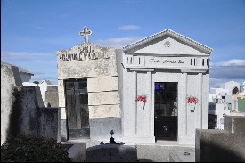 unfortunately was washed away by the river the week previous to our visit. The city center (where opulent neoclassic buildings can be found) was covered with mud and partially closed to traffic due to the ongoing cleaning works. We recommend a visit to the impressive local cemetery, a mix of Europeans immigrant graves with heartfelt inscriptions and huge mausoleums of the town’s first families, divided by avenues of huge trees. unfortunately was washed away by the river the week previous to our visit. The city center (where opulent neoclassic buildings can be found) was covered with mud and partially closed to traffic due to the ongoing cleaning works. We recommend a visit to the impressive local cemetery, a mix of Europeans immigrant graves with heartfelt inscriptions and huge mausoleums of the town’s first families, divided by avenues of huge trees.
This charming port town is the point of entry to the popular Torres 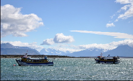 del Paine National Park. Puerto Natales is a good base to explore the area and do some shopping before leaving to the Park where groceries are scarce and overpriced. The town itself is not big but the landscape of fjords and mountains around is beautiful. The vibe is easy going and filled with Gore-Tex backpackers, trekkers and so on. Good to chill-out for a couple of days. del Paine National Park. Puerto Natales is a good base to explore the area and do some shopping before leaving to the Park where groceries are scarce and overpriced. The town itself is not big but the landscape of fjords and mountains around is beautiful. The vibe is easy going and filled with Gore-Tex backpackers, trekkers and so on. Good to chill-out for a couple of days.
This world renowned national park with an extension of more than 180,000 ha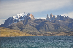 was declared a Unesco Biosphere Reserve in 1978. Since then it has suffered many fires, last one in October which burned all the southern forest. It is heartbreaking to see such a beautiful place almost treeless. The park is filled with expensive eco-hotels which are far too close to the mountains. As a visitor you have mixed feelings, as this is truly a unique place but somehow it has turned into a money making machine. Talking to the rangers, there are only 22 for the whole park and they just cannot cope with the 200,000 annual visitors. Nevertheless the scenery is postcard perfect and there are multiple day hiking trips suitable for all levels of fitness. We think Laguna Azul is the best camping spot (wild camping is not allowed) with outstanding views of the Torres and with very friendly owners. was declared a Unesco Biosphere Reserve in 1978. Since then it has suffered many fires, last one in October which burned all the southern forest. It is heartbreaking to see such a beautiful place almost treeless. The park is filled with expensive eco-hotels which are far too close to the mountains. As a visitor you have mixed feelings, as this is truly a unique place but somehow it has turned into a money making machine. Talking to the rangers, there are only 22 for the whole park and they just cannot cope with the 200,000 annual visitors. Nevertheless the scenery is postcard perfect and there are multiple day hiking trips suitable for all levels of fitness. We think Laguna Azul is the best camping spot (wild camping is not allowed) with outstanding views of the Torres and with very friendly owners.
The border crossing from Los Antiguos (Argentina) to Chile Chico by the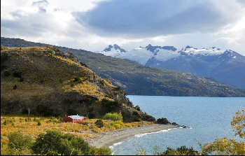 Lago General Carrera is straight forward. Instead of taking the ferry to Puerto Ibañez we followed the Carretera Austral around the lake’s western shores to El Maitén; it is a very beautiful area with tiny villages, lakes and vegetation surrounded by huge snowcapped mountains behind. If having time it is worth taking the detour in Puerto Tranquilo to the Exploradores Glacier (50 km on the side road). This valley is truly isolated and unspoiled filled with fiorjds, crystal blue lakes and some stretches of rainforest. If hungry you can visit Alacaluf guesthouse run by a friendly Germany family (the valley’s only inhabitants) who decided 11 years ago to settle down in this remote place. Back on the Carretera Austral, the ripio road continues to Villa Cerro Castillo, where you can admire the fairytale castle peaks of Cerro Castillo National Reserve. There is a challenging 4-day trek around the Cerro, a good option to avoid the Torres del Paine crowds. From here the road is paved going through pine forested mountains until arriving in Cohayique the region’s capital and the only place among the Carretera that offers a wide range of services, good to visit Austral Shipping to check out their ferry schedules. Lago General Carrera is straight forward. Instead of taking the ferry to Puerto Ibañez we followed the Carretera Austral around the lake’s western shores to El Maitén; it is a very beautiful area with tiny villages, lakes and vegetation surrounded by huge snowcapped mountains behind. If having time it is worth taking the detour in Puerto Tranquilo to the Exploradores Glacier (50 km on the side road). This valley is truly isolated and unspoiled filled with fiorjds, crystal blue lakes and some stretches of rainforest. If hungry you can visit Alacaluf guesthouse run by a friendly Germany family (the valley’s only inhabitants) who decided 11 years ago to settle down in this remote place. Back on the Carretera Austral, the ripio road continues to Villa Cerro Castillo, where you can admire the fairytale castle peaks of Cerro Castillo National Reserve. There is a challenging 4-day trek around the Cerro, a good option to avoid the Torres del Paine crowds. From here the road is paved going through pine forested mountains until arriving in Cohayique the region’s capital and the only place among the Carretera that offers a wide range of services, good to visit Austral Shipping to check out their ferry schedules.
This part of the carretera is mainly ripio and frequently in very poor condition. The route passes 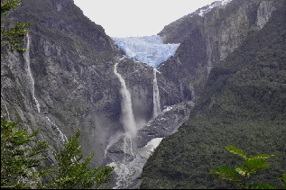 by farmland until Villa Amengual, the nature will be more pristine the closer you get to Queulat National Park. The highlight there is visiting the Ventisquero Colgante (hanging glacier). It is better to choose the longest trail (2.5 hrs) as it will take you to a great viewpoint through dense Andean forest where you can watch the ice fall into huge sugar like waterfalls. This is a large park with many other waterfalls, glaciers etc., but unfortunately the CONAF staff are not very helpful or interested in giving you any extra information. After the park you will find Puyuhuapi which lies in a peaceful bay at the northern end of the Puyuahuapi fjord. Its picturesque German influenced houses and decent family run lodging and fish restaurants makes it the best stopping point between Chaitén and Coyhaique. Don’t miss the Ventisquero outdoor hot springs 6km south of town, with beautiful views over the bay and the virgin forest, perfect to chill out for a couple of hours. by farmland until Villa Amengual, the nature will be more pristine the closer you get to Queulat National Park. The highlight there is visiting the Ventisquero Colgante (hanging glacier). It is better to choose the longest trail (2.5 hrs) as it will take you to a great viewpoint through dense Andean forest where you can watch the ice fall into huge sugar like waterfalls. This is a large park with many other waterfalls, glaciers etc., but unfortunately the CONAF staff are not very helpful or interested in giving you any extra information. After the park you will find Puyuhuapi which lies in a peaceful bay at the northern end of the Puyuahuapi fjord. Its picturesque German influenced houses and decent family run lodging and fish restaurants makes it the best stopping point between Chaitén and Coyhaique. Don’t miss the Ventisquero outdoor hot springs 6km south of town, with beautiful views over the bay and the virgin forest, perfect to chill out for a couple of hours.
The Chaiten volcano eruption in 2008 / 2009 and its large amounts of ash and debris t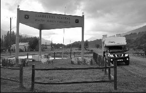 ransformed Chaiten into a ghost town. Reconstruction works are on the way, but still the town is half empty and many building have been abandoned. It is a good stopover to withdraw cash at the only ATM and for buying food and fuel before heading north into the Pumalin Reserve. If you are planning to cross by ferry from Caleta Gonzalo to Hornipiren you will need to buy the ticket here at Naviera Austral Office. A nicer alternative to Chaitén is camping is at nearby Santa Barbara beach, 10km north, on the road to Pumalin NP with great views over the Corcovado volcano and Morro Volcano. Pumalin’s Park information centre has been relocated to El Amarillo. ransformed Chaiten into a ghost town. Reconstruction works are on the way, but still the town is half empty and many building have been abandoned. It is a good stopover to withdraw cash at the only ATM and for buying food and fuel before heading north into the Pumalin Reserve. If you are planning to cross by ferry from Caleta Gonzalo to Hornipiren you will need to buy the ticket here at Naviera Austral Office. A nicer alternative to Chaitén is camping is at nearby Santa Barbara beach, 10km north, on the road to Pumalin NP with great views over the Corcovado volcano and Morro Volcano. Pumalin’s Park information centre has been relocated to El Amarillo.
Pumalin is a remarkable forest-conservation effort owned by billionaire American Doug Tompkins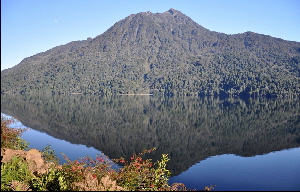 . If you can only visit one park in Chile this should be the one. On the other side of the border at Alerces NP in Argentina, you will pay an expensive entrance fee and boat trip to be able to see the actual Alerces. Here in Pumalin the impressive ancient trees can be seen in most of the self-guided trails which go through unspoiled Andean forest. The private reserve of 320,000 ha has been given Nature Sanctuary status and is just spectacularly beautiful. The best camping for those with vehicles is “El Volcán”. There is an information point at Caleta Gonzalo by the harbour. . If you can only visit one park in Chile this should be the one. On the other side of the border at Alerces NP in Argentina, you will pay an expensive entrance fee and boat trip to be able to see the actual Alerces. Here in Pumalin the impressive ancient trees can be seen in most of the self-guided trails which go through unspoiled Andean forest. The private reserve of 320,000 ha has been given Nature Sanctuary status and is just spectacularly beautiful. The best camping for those with vehicles is “El Volcán”. There is an information point at Caleta Gonzalo by the harbour.
The ferry trip from Caleta Gonzalo to Hornopiren is beautiful and goes along the 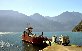 Pumalin’s vast area of protected virgin rainforest. It is truly a unique experience. Hornopiren is a peaceful fishing village and is safe to park at the water front. To get to Puerto Montt another ferry is needed to go across Roloncovi Stuary. No advance booking required, first comes first served. For most travelers it is a much nicer option to stay at Puerto Varas instead of Puerto Montt. We highly recommend the Hostel Compass del Sur, which is having a truly homely atmosphere and pretty and convenient backyard to park your car. The communal facilities (bathroom, kitchen and living room) are neat and clean. Nice to place to relax before crossing the border to Argentina…bye bye Chile!! Pumalin’s vast area of protected virgin rainforest. It is truly a unique experience. Hornopiren is a peaceful fishing village and is safe to park at the water front. To get to Puerto Montt another ferry is needed to go across Roloncovi Stuary. No advance booking required, first comes first served. For most travelers it is a much nicer option to stay at Puerto Varas instead of Puerto Montt. We highly recommend the Hostel Compass del Sur, which is having a truly homely atmosphere and pretty and convenient backyard to park your car. The communal facilities (bathroom, kitchen and living room) are neat and clean. Nice to place to relax before crossing the border to Argentina…bye bye Chile!!

|