Argentina
Argentina is a vast country with an immense and diverse geography from the heat of the Chaco to the stormy Tierra del Fuego. So far driving around the Patagonia has been one of the highlights of our journey, lonely roads crossing endless and empty plateaus which at first glance seem lifeless but are full of wildlife and surrounded by amazing landscape. And don’t forget the meat, barbecued on an open fire at the end of the day. We are now in our way up to the wine land can’t wait to enjoy a nice wine with our asado!!
Crossing the Puyehue pass is very scenic but filled with the 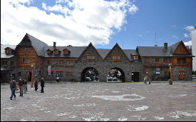 ashes of nearby Chaiten volcano. It goes around the east end of Lago Nauel Huapi and then follows the north side of the lake through La Angostura before arriving in Bariloche, which is situated at the south shore of the lake. Its location is perfect to explore the area. We highly recommend the 60 km “Circuito Chico” which is an easy excursion along beautiful lakes, mountains and forest all part of the Nauel Huapi National Park. This area is extremely popular in both summer and winter; try to visit in between to avoid the crowds and the high prices. ashes of nearby Chaiten volcano. It goes around the east end of Lago Nauel Huapi and then follows the north side of the lake through La Angostura before arriving in Bariloche, which is situated at the south shore of the lake. Its location is perfect to explore the area. We highly recommend the 60 km “Circuito Chico” which is an easy excursion along beautiful lakes, mountains and forest all part of the Nauel Huapi National Park. This area is extremely popular in both summer and winter; try to visit in between to avoid the crowds and the high prices.
This fertile valley surrounded by mountains was a mecca in the 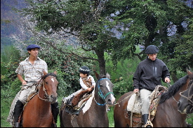 70’s when it attracted thousands of hippies eager to create an alternative way of living. Some of them stayed and now produce handicrafts or run organic farms. They sell their products in the famous craft market at the main plaza on Tuesdays, Thursday and Saturdays. There are also many hiking opportunities, ask at the tourist information, the staff is very friendly and knowledgeable. We got to know there about a Gaucho festival at nearby Lago Epuyen which was a lot of fun to watch. Beautiful horses and great asado!! 70’s when it attracted thousands of hippies eager to create an alternative way of living. Some of them stayed and now produce handicrafts or run organic farms. They sell their products in the famous craft market at the main plaza on Tuesdays, Thursday and Saturdays. There are also many hiking opportunities, ask at the tourist information, the staff is very friendly and knowledgeable. We got to know there about a Gaucho festival at nearby Lago Epuyen which was a lot of fun to watch. Beautiful horses and great asado!!
Esquel is friendly town in a fertile valley surrounded by mountains.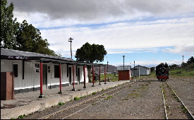 It is a great base to visit Los Alerces National Park (unfortunately it didn’t stop raining while we were there). In winter you can go skiing, if visiting in summer you can ride the narrow gauge train La Trochita up to El Maitén. At the time we were there it only run twice a week, so check in advance. Many Welsh pioneers settled in the area in the late 19th century which can be seen in the town’s streets and shops names. It is a great base to visit Los Alerces National Park (unfortunately it didn’t stop raining while we were there). In winter you can go skiing, if visiting in summer you can ride the narrow gauge train La Trochita up to El Maitén. At the time we were there it only run twice a week, so check in advance. Many Welsh pioneers settled in the area in the late 19th century which can be seen in the town’s streets and shops names.
This is the largest city in the Chubut province, nothing special but 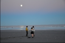 good for shopping and a convenient stop along the eastern coastline (Route 3). It is better to stay 8 km south at Rada Tilly. This is a quiet village with a good municipality camping (all facilities available) which is located in walking distance to the beach, great for watching sunset and having an afternoon stroll. good for shopping and a convenient stop along the eastern coastline (Route 3). It is better to stay 8 km south at Rada Tilly. This is a quiet village with a good municipality camping (all facilities available) which is located in walking distance to the beach, great for watching sunset and having an afternoon stroll.
This is Argentina’s largest area of Petrified Forest. The araucarias, 1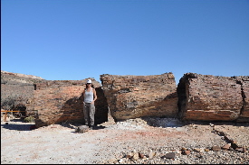 40 million years old, lie in a desert which was once a forest. The entrance is free and there is a trail 1 km long that passes by the most impressive petrified trees in the park. The landscape around is Patagonia pure, very scenic and beautiful. Wild camping is not permitted but you can park along the dirt road outside the park in the middle of the pampa. Interesting museum about what can be found in the park with easy to follow explanations inside the ranger’s building. 40 million years old, lie in a desert which was once a forest. The entrance is free and there is a trail 1 km long that passes by the most impressive petrified trees in the park. The landscape around is Patagonia pure, very scenic and beautiful. Wild camping is not permitted but you can park along the dirt road outside the park in the middle of the pampa. Interesting museum about what can be found in the park with easy to follow explanations inside the ranger’s building.
If you are in the area we highly recommend visiting this national 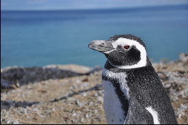 park (no entrance fee!). Monte Leon beaches and islands are an important breeding area for cormorants, see lions and penguins. There are also guanacos and pumas (which are very difficult to spot). Before visiting the park you should inquire about the tide’s schedule. Visiting it in low tide and full moon is an amazing experience; it is then when you can fully admire the impressive rock formations and explore the wide isolated beaches. Wild camping is forbidden and the only camping available is nicely located but pricey. park (no entrance fee!). Monte Leon beaches and islands are an important breeding area for cormorants, see lions and penguins. There are also guanacos and pumas (which are very difficult to spot). Before visiting the park you should inquire about the tide’s schedule. Visiting it in low tide and full moon is an amazing experience; it is then when you can fully admire the impressive rock formations and explore the wide isolated beaches. Wild camping is forbidden and the only camping available is nicely located but pricey.
This is a pleasant and conveniently located town with good shopping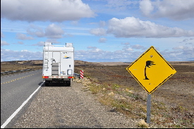 to stock up before heading down to Tierra del Fuego. Many of the soldiers who were sent to the Malvinas war are from this area, so there are plenty of “Las Malvinas son Argentinas” signposts, war statues and so on around. They even have a Malvinas museum. A good place to camp is the nearby and pretty volcano lake Laguna Azul, south of town 11 km before the Chilean border. to stock up before heading down to Tierra del Fuego. Many of the soldiers who were sent to the Malvinas war are from this area, so there are plenty of “Las Malvinas son Argentinas” signposts, war statues and so on around. They even have a Malvinas museum. A good place to camp is the nearby and pretty volcano lake Laguna Azul, south of town 11 km before the Chilean border.
Tierra del Fuego is the largest island off the extreme south of the continent. 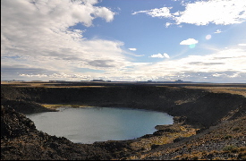 The Andes run from west to east, so the north is flat, covered with vast farms which plains expand to the horizon with a fauna of thousands of sheep, guanacos and birds; while the south has mountains, deep lakes and forests. It is not complicated to cross all borders but time consuming. Lots of paper work, ferry crossing, queuing etc. It doesn’t make any sense to exit Argentina, enter Chile, drive a gravel road for 80km and take a ferry to again drive another gravel road, in terrible condition by the way, to reach the Argentinian border. When arriving at Rio Grande to fill up your car, head to YPF petrol station, it is having nice showers and free Wi-Fi. The Andes run from west to east, so the north is flat, covered with vast farms which plains expand to the horizon with a fauna of thousands of sheep, guanacos and birds; while the south has mountains, deep lakes and forests. It is not complicated to cross all borders but time consuming. Lots of paper work, ferry crossing, queuing etc. It doesn’t make any sense to exit Argentina, enter Chile, drive a gravel road for 80km and take a ferry to again drive another gravel road, in terrible condition by the way, to reach the Argentinian border. When arriving at Rio Grande to fill up your car, head to YPF petrol station, it is having nice showers and free Wi-Fi.
We were very excited to get to here, the most southernmost city in the world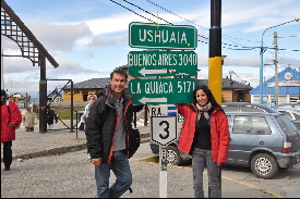 AND a big milestone in our trip after all the difficult times we had. Ushuaia is located on the northern shore of the beautiful Beagle Channel. For many this is the end of the world, and it feels a like bit like this. It is a touristic town but very pleasant. For boat trips go to the harbor, you will find plenty of information from half-day tours around the bay to cruises to Antarctica (very tempting!!! ... but unfortunately not this time for us). We recommend Patagonia Adventure Explorer, they do the standard trip plus walking along Isla Bridges. Their guides are very good. The views of the surrounding mountains and spotting whales, penguins and see lions makes worth the boat trip. AND a big milestone in our trip after all the difficult times we had. Ushuaia is located on the northern shore of the beautiful Beagle Channel. For many this is the end of the world, and it feels a like bit like this. It is a touristic town but very pleasant. For boat trips go to the harbor, you will find plenty of information from half-day tours around the bay to cruises to Antarctica (very tempting!!! ... but unfortunately not this time for us). We recommend Patagonia Adventure Explorer, they do the standard trip plus walking along Isla Bridges. Their guides are very good. The views of the surrounding mountains and spotting whales, penguins and see lions makes worth the boat trip.
This is a small but pretty national park which stretches west to the Chilean 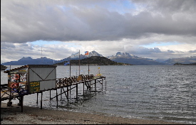 border and north to Lake Fagnano (large areas are closed to the public). The best walk is Senda Costera (trekking maps available at the park entrance) which ends at Ensenada Bay, with beautiful views over the lake and Isla Redonda. You will find there a friendly post officer who sells stamped postcards with “end of the world” logo which are official and can be sent to anywhere in the world (the office includes a postbox). Ok it is your typical tourist staff but our families loved getting their postcards from the end of the world! border and north to Lake Fagnano (large areas are closed to the public). The best walk is Senda Costera (trekking maps available at the park entrance) which ends at Ensenada Bay, with beautiful views over the lake and Isla Redonda. You will find there a friendly post officer who sells stamped postcards with “end of the world” logo which are official and can be sent to anywhere in the world (the office includes a postbox). Ok it is your typical tourist staff but our families loved getting their postcards from the end of the world!
The drive to Tolhuin through the Garibaldi Pass is very scenic. 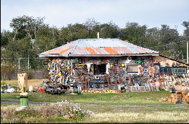 This small town is located at the eastern tip of Lake Fagnano about 1 hr. from Rio Grande and is a popular BBQ and fishing spot among locals especially on summer holidays. There is a very famous bakery in town “Panificadora La Unión” which we found ok but not that great as everyone said. It is possible to camp wild by the lake but they recommended us to stay at the “unique” Camping Hain, friendly and easy going artsy atmosphere. The local museum located next door gives a good impression of the local history and aboriginal people who used to live in the area. Both Chile and Argentina are trying to recover the history of their aboriginal Patagonian and somehow restore their culture heritage which was destroyed by the early western settlers. This small town is located at the eastern tip of Lake Fagnano about 1 hr. from Rio Grande and is a popular BBQ and fishing spot among locals especially on summer holidays. There is a very famous bakery in town “Panificadora La Unión” which we found ok but not that great as everyone said. It is possible to camp wild by the lake but they recommended us to stay at the “unique” Camping Hain, friendly and easy going artsy atmosphere. The local museum located next door gives a good impression of the local history and aboriginal people who used to live in the area. Both Chile and Argentina are trying to recover the history of their aboriginal Patagonian and somehow restore their culture heritage which was destroyed by the early western settlers.
El Calafate is located on the shores of the emerald green Lago Argentino. 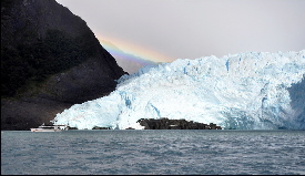 The town is not especially attractive but the landscape around is very pretty. Everyone here comes to visit Perito Moreno Glacier or they are in their way to Torres Del Paine or El Chaltén. The main street is good for people watching, shopping, etc. There are many cafés, restaurants and plenty of agencies offering many activities and day trips for all budgets and fitness level. 10 minutes away from the center is Bahia Redonda where flamingos and swans can be seen. Good to chill out for a couple of days. The town is not especially attractive but the landscape around is very pretty. Everyone here comes to visit Perito Moreno Glacier or they are in their way to Torres Del Paine or El Chaltén. The main street is good for people watching, shopping, etc. There are many cafés, restaurants and plenty of agencies offering many activities and day trips for all budgets and fitness level. 10 minutes away from the center is Bahia Redonda where flamingos and swans can be seen. Good to chill out for a couple of days.
This is a World Heritage Site home to 13 mayor glaciers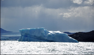 hence 40% of the 724,000 ha of the park is covered by ice fields. At the western end of Lago Argentino the mayor attraction is the Perito Moreno. This glacier was born to be star; it descends to the surface of the water over a 5km frontage and a height of about 60-80 m. There are viewpoints all over the place which gives everyone the opportunity to watch this amazing vivid blue glacier from all angels. We highly recommend Hielo & Aventure Big Ice trek with crampons over the glacier, this is truly an unforgettable experience! Another area of the park worth a visit is Upsala and Spegazzini Glaciers (can be reached by boat from Punta Banderas). The negative side is the entrance fee, 100 pesos/person only valid for 1 day, so if you want to see different glaciers in consecutive days you need to pay again the park fee. hence 40% of the 724,000 ha of the park is covered by ice fields. At the western end of Lago Argentino the mayor attraction is the Perito Moreno. This glacier was born to be star; it descends to the surface of the water over a 5km frontage and a height of about 60-80 m. There are viewpoints all over the place which gives everyone the opportunity to watch this amazing vivid blue glacier from all angels. We highly recommend Hielo & Aventure Big Ice trek with crampons over the glacier, this is truly an unforgettable experience! Another area of the park worth a visit is Upsala and Spegazzini Glaciers (can be reached by boat from Punta Banderas). The negative side is the entrance fee, 100 pesos/person only valid for 1 day, so if you want to see different glaciers in consecutive days you need to pay again the park fee.
Driving from El Calafate the Route 40 is partially paved but gets quite rough in some areas. They started the road works on 2009 but we think it will take another 3 years to be completed. Nevertheless this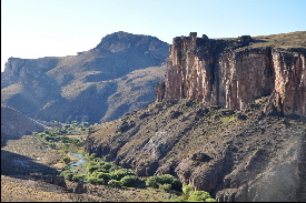 part of the country is still isolated and the pampa seems to be endless wide, this is truly a remarkable landscape. You will encounter many Patagonian animals on the way but unfortunately we still haven’t seen a puma! The Cueva de la Manos is a less known park but if you are in the area it shouldn’t be missed. It is located in a beautiful volcano canyon containing a series of galleries with 10,000 year old impressive paintings of human hands and animals in various colours. The setting is perfect for sunset and the guides (you are not allowed to go by yourself) are very knowledgeable and enthusiastic about their work. part of the country is still isolated and the pampa seems to be endless wide, this is truly a remarkable landscape. You will encounter many Patagonian animals on the way but unfortunately we still haven’t seen a puma! The Cueva de la Manos is a less known park but if you are in the area it shouldn’t be missed. It is located in a beautiful volcano canyon containing a series of galleries with 10,000 year old impressive paintings of human hands and animals in various colours. The setting is perfect for sunset and the guides (you are not allowed to go by yourself) are very knowledgeable and enthusiastic about their work.
From Cueva de las Manos, route 40 improves considerably all the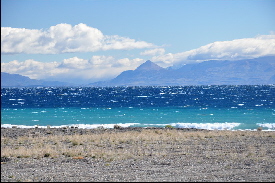 way to the border with Chile passing by Los Antiguos, a pretty village on the shore of Buenos Aires lake with many trees areas which feels like a little oasis after the emptiness of the pampa. Lago Buenos Aires is the second largest in South America and is shared by both Argentina and Chile, where it is called Lago General Carrera (yet another sign of the tight relationship existing between the countries). The border crossing at Paso Jeinemeni is hassle-free. way to the border with Chile passing by Los Antiguos, a pretty village on the shore of Buenos Aires lake with many trees areas which feels like a little oasis after the emptiness of the pampa. Lago Buenos Aires is the second largest in South America and is shared by both Argentina and Chile, where it is called Lago General Carrera (yet another sign of the tight relationship existing between the countries). The border crossing at Paso Jeinemeni is hassle-free.
After crossing the easy going border through Samore Pass you will find the junction to the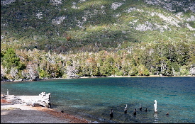 scenic “Siete Lagos” route. It runs south from San Martín de los Andes to Bariloche via Lago Hermoso and passes beautiful stretches of blue and emerald lakes framed by steep forested mountains. The ripio road is well-maintained and there is plenty of free camping along the route. San Martin de los Andes is a small upscale tourist town located on the shores of Lago Lácar. In our opinion it is much more pleasant than Bariloche or Villa La Angostura. Good for hiking around the surrounding forested trails but the popular Mirador Bandurria is having its viewpoint very much obstructed by the trees and you cannot see much. scenic “Siete Lagos” route. It runs south from San Martín de los Andes to Bariloche via Lago Hermoso and passes beautiful stretches of blue and emerald lakes framed by steep forested mountains. The ripio road is well-maintained and there is plenty of free camping along the route. San Martin de los Andes is a small upscale tourist town located on the shores of Lago Lácar. In our opinion it is much more pleasant than Bariloche or Villa La Angostura. Good for hiking around the surrounding forested trails but the popular Mirador Bandurria is having its viewpoint very much obstructed by the trees and you cannot see much.
After leaving behind the sparkling lakes and wooded mountain valleys of the Lake District,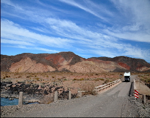 route 40 heads north to Neuquén Province, rich in dinosaurs, fossils, red sedimentary rocks and extinct volcanoes. The contrast is huge, but the arid landscape is just beautiful and best of all it finally gets warmer and dryer! A good place to stay overnight along this route is Laguna Blanca, a protected reserve close to Zapala, perfect to have a sunset walk along the beach watching the flamingos. Further north the road leads to Malargüe valley with its open landscape, vast grassland and high peak volcanoes and even if it doesn’t look like, it snows in winter and the prestigious sky resort of Las Leñas is also located there. Back in the Pampas the road goes through Valle Hermoso to El Nihuil Dam, this is very pretty drive (some rough ripio) with many polychrome formations and water streams. Perhaps the most spectacular would be Atuel Canyon, but skip the northern part as it is filled with dozens run-down tourist campsites. Better to stay overnight at El Nihuil village or directly in the Canyon. route 40 heads north to Neuquén Province, rich in dinosaurs, fossils, red sedimentary rocks and extinct volcanoes. The contrast is huge, but the arid landscape is just beautiful and best of all it finally gets warmer and dryer! A good place to stay overnight along this route is Laguna Blanca, a protected reserve close to Zapala, perfect to have a sunset walk along the beach watching the flamingos. Further north the road leads to Malargüe valley with its open landscape, vast grassland and high peak volcanoes and even if it doesn’t look like, it snows in winter and the prestigious sky resort of Las Leñas is also located there. Back in the Pampas the road goes through Valle Hermoso to El Nihuil Dam, this is very pretty drive (some rough ripio) with many polychrome formations and water streams. Perhaps the most spectacular would be Atuel Canyon, but skip the northern part as it is filled with dozens run-down tourist campsites. Better to stay overnight at El Nihuil village or directly in the Canyon.
Mendoza is the main city of the wine region and all guide books say that this is such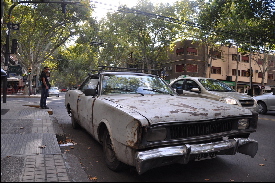 a dynamic and attractive town for visitors. Maybe some years ago but this is not what we experienced. The city is dirty, full of potholes, abandoned public parks; the traffic lights don’t work etc. Don’t try to get things done in 1 day everything closes down between 12.30 until 17.00 or later. We were a little bit disappointed by the bodegas as well, the quality of the wines in the region is great but if looking for real charming and picturesque vineyards we would suggest visiting Salta instead, specially the area around Cafayate. Nevertheless if staying in Mendoza we recommend Camping Suizo, great place to chill out and meet other travelers. a dynamic and attractive town for visitors. Maybe some years ago but this is not what we experienced. The city is dirty, full of potholes, abandoned public parks; the traffic lights don’t work etc. Don’t try to get things done in 1 day everything closes down between 12.30 until 17.00 or later. We were a little bit disappointed by the bodegas as well, the quality of the wines in the region is great but if looking for real charming and picturesque vineyards we would suggest visiting Salta instead, specially the area around Cafayate. Nevertheless if staying in Mendoza we recommend Camping Suizo, great place to chill out and meet other travelers.
There are two possibilities to reach this area from Mendoza either taking Ruta 40 or Ruta 7; 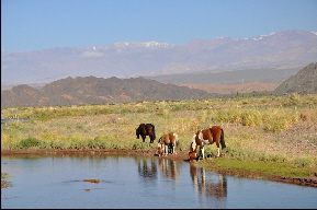 we recommend the latter which is far more scenic. The popular local weekend destinations outside Mendoza such as Cacheuta or Potrerillos are just ok so better head further north to Calingasta. The first inhabitants that lived in the area belonged to the Huarpe cultue and in Diaguita language Calin means chief and Gasta people or nation. Be aware of the curvy road, it follows snowy Andean peaks, valleys and rivers and we even saw condors and guanacos. It hardly every rain so the clear skies are perfect to watch the stars and constellations at night. The little villages are filled with adobe houses and are very peaceful especially during the 5 hour siesta break but after sunset and early morning they come to life. We recommend visiting Pampa El Leoncito for spectacular views over the Cordillera, Rodeo and its Cuesta del Viento Reservoir and the Pismata volcanic water springs. we recommend the latter which is far more scenic. The popular local weekend destinations outside Mendoza such as Cacheuta or Potrerillos are just ok so better head further north to Calingasta. The first inhabitants that lived in the area belonged to the Huarpe cultue and in Diaguita language Calin means chief and Gasta people or nation. Be aware of the curvy road, it follows snowy Andean peaks, valleys and rivers and we even saw condors and guanacos. It hardly every rain so the clear skies are perfect to watch the stars and constellations at night. The little villages are filled with adobe houses and are very peaceful especially during the 5 hour siesta break but after sunset and early morning they come to life. We recommend visiting Pampa El Leoncito for spectacular views over the Cordillera, Rodeo and its Cuesta del Viento Reservoir and the Pismata volcanic water springs.
This is a prominent paleontological area which was declared in November 2000 “World Heritage 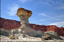 Site” by UNESCO. Ischigualasto National Park was in the Triassic period 230 millions of years ago, dinosaurs land. The world oldest fossils have been found here. The beautiful moon-like surrounding and bizarre sculptural desert landscape is unique. It is better to arrive early in the morning as tourists are only allowed to visit the park with a ranger and cues are long (vehicle convoy). Inexpensive camping ground opposite the ranger stations is possible. Nearby Talampaya National Park is well worth a visit, unfortunately it didn’t stop raining while we were there. Site” by UNESCO. Ischigualasto National Park was in the Triassic period 230 millions of years ago, dinosaurs land. The world oldest fossils have been found here. The beautiful moon-like surrounding and bizarre sculptural desert landscape is unique. It is better to arrive early in the morning as tourists are only allowed to visit the park with a ranger and cues are long (vehicle convoy). Inexpensive camping ground opposite the ranger stations is possible. Nearby Talampaya National Park is well worth a visit, unfortunately it didn’t stop raining while we were there.
La Rioja city is surrounded by the Sierra Velasco and 25 de Mayo is the heart of the town and a good base to explore the nearby historical buildings, the Cathedral, San Francisco Church and the Inca Huasi Archeological Museum. The cafes and restaurants around the plaza are good for people watching even though the town only comes alive after the daily siesta. Dique Los Sauces, 15km west on Ruta 75 is a good place to park and stay overnight. Following this same route is the starting point of the so called Costa Riojana, a corridor of silent villages dyed by arid and reddish wall landscapes among olive groves, fruits and walnut trees. Fill up the tank as the petrol stations are far away from each other.
Catamarca is capital of its province but there is little to keep you there, however the n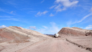 earby Puna (high altitude desert) is spectacular with views over Pissis the 2nd largest mountain in South America. It is easiest to reach it by paved road to Aimogasta or north to Andagalá or to Belén. The archeological museum in Andagalá is a hidden gem; it is unfortunate that such quality display of Diaguita artifacts and burials vases don’t have a better place to be shown to the public. The road to Belén to Mollecito is largely unpaved, going up to Cuesta de Chilca (impressive views over the valley). This road is extremely narrow and filled with potholes. From there the landscape changes dramatically as you reach the small villages in the forested mountains of Los Alisos National Park. This is the most direct route but it includes driving through ill-maintained, narrow and sometimes densely foggy roads. earby Puna (high altitude desert) is spectacular with views over Pissis the 2nd largest mountain in South America. It is easiest to reach it by paved road to Aimogasta or north to Andagalá or to Belén. The archeological museum in Andagalá is a hidden gem; it is unfortunate that such quality display of Diaguita artifacts and burials vases don’t have a better place to be shown to the public. The road to Belén to Mollecito is largely unpaved, going up to Cuesta de Chilca (impressive views over the valley). This road is extremely narrow and filled with potholes. From there the landscape changes dramatically as you reach the small villages in the forested mountains of Los Alisos National Park. This is the most direct route but it includes driving through ill-maintained, narrow and sometimes densely foggy roads.
Tucumán is the capital of a province rich in sugar, tobacco and citrus fruits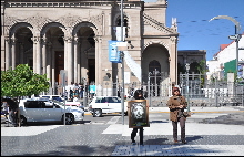 . You will find many towns filled with lines of orange trees in their streets. The city itself is not very attractive, but it is a good stop to withdraw cash and for buying food and fuel (or visit the car workshop). We wanted to stay at the municipality camping which is located in a forested area close the local university but the guards told us to look for an alternative place outside town as daily robberies are common there. Not sure if this is true or not but you can make your own decision. Nevertheless we decided to retreat to the nearby mountain town of Tafi del Valle. This is a pretty village overlooking a lake with a relaxed vibe and easy going atmosphere, good to chill out for a couple of days. If you are there on February you can enjoy the popular National Cheese Festival. . You will find many towns filled with lines of orange trees in their streets. The city itself is not very attractive, but it is a good stop to withdraw cash and for buying food and fuel (or visit the car workshop). We wanted to stay at the municipality camping which is located in a forested area close the local university but the guards told us to look for an alternative place outside town as daily robberies are common there. Not sure if this is true or not but you can make your own decision. Nevertheless we decided to retreat to the nearby mountain town of Tafi del Valle. This is a pretty village overlooking a lake with a relaxed vibe and easy going atmosphere, good to chill out for a couple of days. If you are there on February you can enjoy the popular National Cheese Festival.
From Tafi del Valle the paved road runs over the Infiernillo pass (3040m), this is 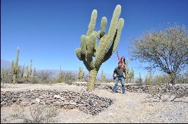 a very scenic drive with views over Amaicha del Valle, 6 meter high cactus and snowcapped volcanoes…really nice! 5 km off the main road are the ruins of Quilmes, this pre-Hispanic indigenous Andean fortress dates from about AD1000. The Quilmes fought fiercely against the Incas and the Spaniards but many of last inhabitants were deported to Buenos Aires. The ruins are shown by Quilmes people who have been fighting for decades to gain back this area to their community. The situation of the indigenous people in Northern Argentina is complicated and the ownership of the land is still questioned. Who is having the right to own it? That is one of the biggest issue in the continent and a very complex one. a very scenic drive with views over Amaicha del Valle, 6 meter high cactus and snowcapped volcanoes…really nice! 5 km off the main road are the ruins of Quilmes, this pre-Hispanic indigenous Andean fortress dates from about AD1000. The Quilmes fought fiercely against the Incas and the Spaniards but many of last inhabitants were deported to Buenos Aires. The ruins are shown by Quilmes people who have been fighting for decades to gain back this area to their community. The situation of the indigenous people in Northern Argentina is complicated and the ownership of the land is still questioned. Who is having the right to own it? That is one of the biggest issue in the continent and a very complex one.
The valley north and south of Cafayate is known as Valles Calchaquies. It is one of the most b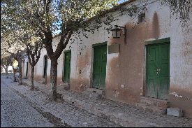 eautiful and interesting region in the country! It is a combination of ragged landscape, a mix of colonial and adobe villages, surrounded by wine yards producing the local specialties, Torrontes and Malbec. Cafayate Tourist Office provides a map with all participating Bodegas along the Salta wine route. Ruta 40 to Cachi is having impressive rock formations such as Quebrada de las Flechas up through Andean foothills with unspoiled villages, being our favorite Los Molinos. 20km west of Los Molinos is Bodega Colome, which you should visit if you are in the area. The landscape is just beautiful and the vineyard also displays part of the Hess Art collection. It is odd to find such a world class exhibition in the middle of nowhere. We believe Salta province should be included in everyone’s list when visiting the country. eautiful and interesting region in the country! It is a combination of ragged landscape, a mix of colonial and adobe villages, surrounded by wine yards producing the local specialties, Torrontes and Malbec. Cafayate Tourist Office provides a map with all participating Bodegas along the Salta wine route. Ruta 40 to Cachi is having impressive rock formations such as Quebrada de las Flechas up through Andean foothills with unspoiled villages, being our favorite Los Molinos. 20km west of Los Molinos is Bodega Colome, which you should visit if you are in the area. The landscape is just beautiful and the vineyard also displays part of the Hess Art collection. It is odd to find such a world class exhibition in the middle of nowhere. We believe Salta province should be included in everyone’s list when visiting the country.
The road from Cachi to Salta goes through Los Cardones National Park with its giant  cactus and pretty landscape; it then climbs to 3,348m to steep Cuesta del Obisco, which spreads 20km of curves, huge rocks and dusty slopes. Salta City was founded in 1582 and it is an atmospheric place with lots of history and many interesting places to visit. The MAAM archeological museum is excellent. We were surprised by the great curatorial criteria for the exhibition of pieces and mummies. It provides a good understanding of the pre-Hispanic social environment analyzing the complexity of the political, economic and religious organization of the Andean region. Unfortunately the Municipality Camping in Salta City was closed during our time of visit, but we can recommend the Camping in San Lorenzo (approx. 15km from Salta). cactus and pretty landscape; it then climbs to 3,348m to steep Cuesta del Obisco, which spreads 20km of curves, huge rocks and dusty slopes. Salta City was founded in 1582 and it is an atmospheric place with lots of history and many interesting places to visit. The MAAM archeological museum is excellent. We were surprised by the great curatorial criteria for the exhibition of pieces and mummies. It provides a good understanding of the pre-Hispanic social environment analyzing the complexity of the political, economic and religious organization of the Andean region. Unfortunately the Municipality Camping in Salta City was closed during our time of visit, but we can recommend the Camping in San Lorenzo (approx. 15km from Salta).
We decided to relax a couple of days in Chicoana at Sayta a horse riding ranch owned 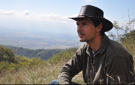 by charismatic Argentinian Enrique. The local scenery of the Valle de Lerma and nearby Cerro’s is beautiful and peaceful. The horseback riding experience is best when stayed overnight at the mountain. Our guide, Javier, is a very professional young gaucho who will give you the insight view (with the good and the bad) into country life in Argentina. He will take you with the horse up on the Cerro’s with magnificent views over the valley, through thick forest and then down to deep river canyons. The horse track includes great asado and lots of wine. by charismatic Argentinian Enrique. The local scenery of the Valle de Lerma and nearby Cerro’s is beautiful and peaceful. The horseback riding experience is best when stayed overnight at the mountain. Our guide, Javier, is a very professional young gaucho who will give you the insight view (with the good and the bad) into country life in Argentina. He will take you with the horse up on the Cerro’s with magnificent views over the valley, through thick forest and then down to deep river canyons. The horse track includes great asado and lots of wine.
From Salta to Jujuy Ruta 9 goes through some stretches of subtropical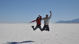 rainforest and along the Campo Alegre dam. But after passing San Juan de Jujuy the landscape changes dramatically. This northern area is called Quebrada de Humahuaca a World Heritage Site by UNESCO which is very rich culturally with many pre-inca ruins and stunning scenary. It runs throughout vast rainbow coloured rock formations with huge cactus in the higher parts and little villages on the river below. We suggest driving the following route: Purmamarca – Tilcara – Humahuaca. Another great place to visit nearby is Salinas Grandes, Salt flats at 3,800m at the Altiplano, better to visit just before sunset for great views! rainforest and along the Campo Alegre dam. But after passing San Juan de Jujuy the landscape changes dramatically. This northern area is called Quebrada de Humahuaca a World Heritage Site by UNESCO which is very rich culturally with many pre-inca ruins and stunning scenary. It runs throughout vast rainbow coloured rock formations with huge cactus in the higher parts and little villages on the river below. We suggest driving the following route: Purmamarca – Tilcara – Humahuaca. Another great place to visit nearby is Salinas Grandes, Salt flats at 3,800m at the Altiplano, better to visit just before sunset for great views!
We were sad to cancel our trip to Bolivia (due unavailability of spare parts for our car). 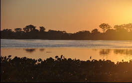 Therefore we were “forced” to make our way to Paraguay. Many Argentinians told us already that the Chaco Area no longer exists and this is true, nowadays it is all about huge Soya and Cornfields. The virgin nature might be gone, but the heat, the humidity and the mosquitos still go strong in this hostile region. There are two good stops en route: La Herradura, a lovely un-touristic village by the Paraguay River and Laguna Blanca at Rio Pilcomayo National Park. We visited the Laguna in the afternoon … don’t step your foot on the Crocodiles which might hang around in the afternoon hours! Therefore we were “forced” to make our way to Paraguay. Many Argentinians told us already that the Chaco Area no longer exists and this is true, nowadays it is all about huge Soya and Cornfields. The virgin nature might be gone, but the heat, the humidity and the mosquitos still go strong in this hostile region. There are two good stops en route: La Herradura, a lovely un-touristic village by the Paraguay River and Laguna Blanca at Rio Pilcomayo National Park. We visited the Laguna in the afternoon … don’t step your foot on the Crocodiles which might hang around in the afternoon hours!

|